So today was a continuation of mapping, using the roads as a guide. The technique often used when mapping boundaries involves finding the point of contact between one unit and the next. Once that point has been located, you follow the boundary along the ground. At a chosen distance, which depends on the size of the area being mapped and the scale of the base map being used, a geologist would then locate themselves using a compass or GPS, collect any relevant data and mark it on the base map. Yes, there is a vast array of technology available to assist with this, along with various agencies with satellite imagery that can be used. But there is nothing like being out in the field and seeing it for real. Doing so usually aids the understanding of complex areas also.
En route to our starting point we found a second fumarole site. This like the last, can be a site used for surface emanation gas sampling during my next visit. Although the surface emanations were individual, there was a row of them covering about 30 meters. Like the previous area, the origin of the emanations were ropey lava flows. However, the small emanations from Day 7 and Day 12 were from a ropey flow low in the stratigraphy. Theses emanations were also concentrated so they were coming through the spatter and volcanic bomb deposits on top of the flow. Today's emanations were coming from a ropey flow higher in the stratigraphy and emanating from fractures and miniature fissures within the flow wall. It was possible to climb up above the emanations, where no obvious emanations on top of the flow were observed.

Surface emanations in the wall of a lava flow
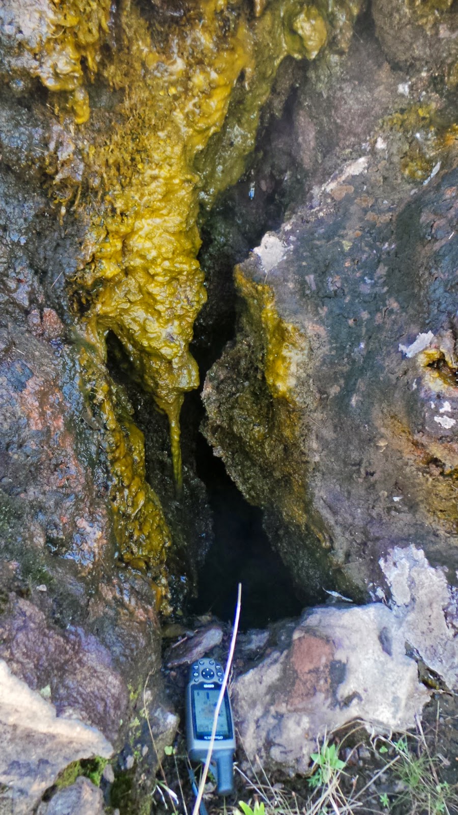
GPS for scale. One of the emanation origins. Not sure what the yellow is. I had thought it would be sulphur, as there is sulphur near by. But there is no smell and it moves in the breeze. It also looks slimy, but isn't. A bacteria of some sort? Answers on a post card please.
We concentrated on the northern part of the caldera, observing the opposite side of some lava flows recorded on Day 10. In this area, some of the ropey lavas are much thicker. I am still trying to establish if they are the same flows previously observed, that have spread across the caldera, or altogether separate. In this region, there appears to be four individual ropey flows, plus another flow lower again in the stratigraphy that cannot be identified at the moment.

This picture was taken standing on a ropey lava flow, looking up to a second overlying flow, topped with a scoria type flow.
As lava doesn't flow in a straight line and quite often forms multiple fingers at the same time it is often a challenge to establish which flow goes with which. This challenge is also added to when the heights and/or thicknesses of flows are also controlled by the underlying topography.
Tomorrow we are off out with Lucy from our accommodation, who is taking us down to the south east corner of the crater where we are hoping there might be evidence of faulting associated with the Solai TVA.
Lala Salama from Kenya!
No comments:
Post a Comment